
$229.95
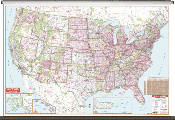
Size 77" W x 54" H. Laminated. Bright, contrasting colors clearly identify political divisions on this 2nd edition Wall Map of the United States by Universal Map. The Special Features and Data contained on this large scale wall map of the United States are as follows: interstate highways, all state highways, time zones, interstate highways, freeways, rivers and lakes, national forests, state lines, mountain ranges, cities and towns. Map Insets Include: Alaska, Hawaii, and Puerto Rico. A special feature of this map is the color coded states. The map is protected with a laminated finish, which is both markable and washable. Framing rails are included on top and bottom for easy wall mounting. Railed wall maps can be turned into pull down maps on spring rollers for an additional $40.
Write Your Own Review