
$229.95
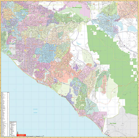
Scale 1:4,164. Size 54" W x 54" H. Laminated. Printed in color with a markable/washable-laminated surface. Provides hanging rails mounted top and bottom. Cities are indexed on the face of the map. Area of coverage ranges: North: to La Habra and Brea; South: includes San Clemente and Dana Point; East: to Seal Beach and Cypress; West: to Orange County border. Details include major streets/all highways, ZIP codes/boundaries, latitude/longitude lines, county lines/names, parks/golf course/amusement centers/stadiums, water features, government buildings/federal penitentiaries, military installations/airports, hospitals, cemeteries, mileage circles, and points of interest. Railed wall maps can be turned into pull down maps on spring rollers for an additional $40.
Write Your Own Review