
$229.95
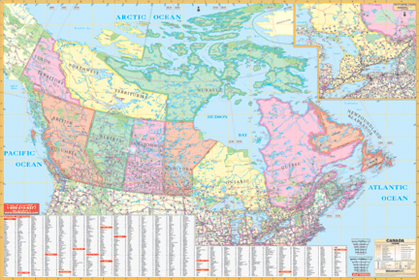
Size 77" W x 54" H. Laminated. The special features and data contained on this Wall Map of Canada by Universal Map are as follows: all state and interstate highways, major waterways, military installations, state parks, towns, cities, Trans-Canada Highway, and time zones. Special features on this map are color-coded provinces, also to include in the United States--New York City, Cleveland, Chicago, Minneapolis/St. Paul, Bismark, Salem (OR), Helena (MT), and insets of South Central Canada. This wall map is lithographed in eight (8) colors. The map is protected by a laminate finish making it markable and washable. Also, the map is indexed on the face of the map. Framing rails are included on top and bottom for easy wall mounting. Railed wall maps can be turned into pull down maps on spring rollers for an additional $40.
Write Your Own Review