
$249.95
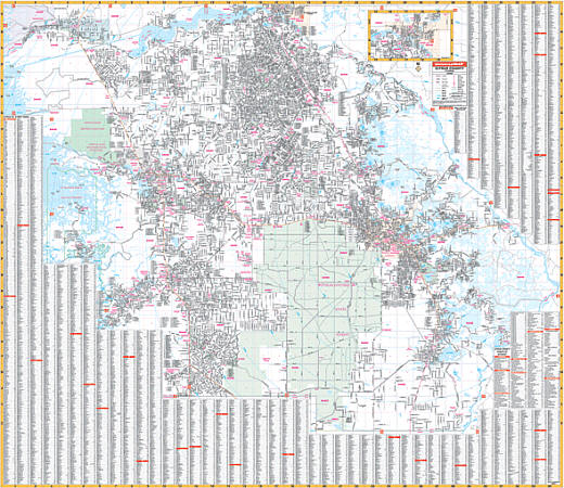
Scale 1:2,346. Size 68" W x 54" H. Laminated. Printed in color with a markable/washable--laminated surface. Street index provided on the face of the map. Framing rails are included on top and bottom for easy wall mounting. Railed wall maps can be turned into pull down maps on spring rollers for an additional $40. Area of coverage: All of Citrus County with the following boundaries: North: to the Levy County line; South: to the Hernando county line; East: to the Sumter/Marion county line; West: to the Gulf of Mexico. Details include all streets and highways, government buildings, airports, water features, fire/police stations, hospitals, shopping centers, educational facilities, railroads, recreational parks, post offices, city limits/annexations, cemeteries, section/township/range, ZIP codes/boundaries, and points of interest.
Write Your Own Review