
$229.95
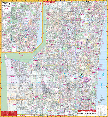
Scale 1:2,560. Size 59" W x 66" H. Laminated. The 5th edition Ft. Lauderdale and Broward County Wall Map by Universal Map has up-to-date cartography with new streets and changes. Coverage runs north to the Palm Beach County line; south to the Dade County line; east: to the Atlantic Ocean; and west to the interchange at I-75 and US-27. Includes an inset map of Boca Raton. Specialty coverage details streets, post offices, hospitals, railroads, mileage circles, section/township/and range lines, airports, cemeteries, shopping centers, water features, recreational parks, city limits, annexations, government buildings, fire/police stations, educational facilities, golf courses/country clubs, ZIP codes/boundaries, and points of interest. Railed wall maps can be turned into pull down maps on spring rollers for an additional $40.
Write Your Own Review