
$249.95
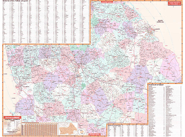
Scale 1:350,000. Size 62" W x 48" H. Laminated. Printed in color with a markable and washable laminated surface with hanging rails mounted on top and bottom. Streets are indexed on the face of the map. Area of coverage: North: Oglethorpe and Lincoln Counties; Northwest: Troup and Monroe Counties; South: Sumpter and Toombs Counties; East: South Carolina State line: West: Alabama State line. Special features show all 58 counties in Central Georgia, color coded counties, a mileage chart between major cities, and new interstate highway exit numbers. Details include interstates, state and federal highways, county roads, airports, hospitals, colleges, water features, parks and national forests, recreation areas, points of interest, longitude and latitude lines, and military installations. Railed wall maps can be turned into pull down maps on spring rollers for an additional $40.
Write Your Own Review