
$249.95
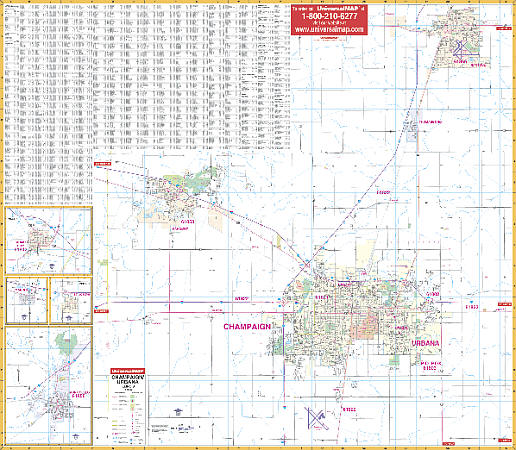
Scale 1:1,986. Size 54" W x 60" H. Laminated. Printed in color with a markable/washable -- laminated surface. Streets are indexed on the face of the map. Boundaries include north to Rantoul; south to the University of Illinois-Willard Airport; east to approximately three miles east of Urbana, and west to Piatt County Line. Includes insets for Farmer City, Mansfield, St. Joseph, and Monticello. Shows all streets/highways, educational institutions, government buildings, shopping centers, hospitals, airports, recreational parks, post offices, golf/country clubs, points of interest, city limits and annexations, railroads, mileage circles, water features, longitude/latitude lines, cemeteries, fire/police stations, ZIP codes/boundaries, and indexing on face of map. Framing rails included on top and bottom for easy wall mounting. Railed wall maps can be turned into pull down maps on spring rollers for an additional $40.
Write Your Own Review