
$229.95
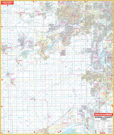
Scale 1:2,640. Size 54" W x 64" H. Laminated. The Kendall County, Illinois Wall Map by Universal Map. Printed in color with a markable/washable--laminated surface. Street index provided in a separate book. Framing rails are included on top and bottom for easy wall mounting. Railed wall maps can be turned into pull down maps on spring rollers for an additional $40. Area of coverage: All of Kendall County with the following boundaries: North: To North Aurora, Warrenville, and Sugar Grove; South: To Morris & the Kankakee River; East: To Bolingbrook, Romeoville, and Joliet; West: To Sandwich, Newark, and Millington. Details include all streets and highways,airports, government buildings, airports, water features, fire/police stations, hospitals, shopping centers, educational facilities, railroads, recreational parks, golf/country clubs, post offices, Section /Township/range lines, mileage circles, city limits/annexations, cemeteries, longitude & latitude, ZIP codes/boundaries, and points of interest.
Write Your Own Review