
$249.95
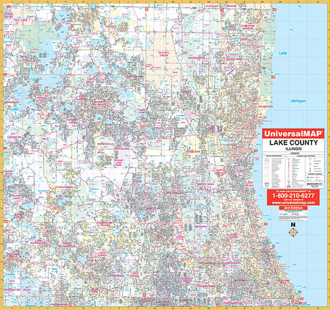
Scale 1:2,640. Size 54" W x 64" H. Laminated. Provides up-to-date cartography with new streets and changes. Printed in color with a markable/washable-laminated surface. Streets indexed in a separate book. Includes hanging rails mounted top and bottom. The area of coverage ranges: North: to the Wisconsin State line; South: to the Cook County line; East: to Lake Michigan; West: to the McHenry County line. Insets: Eastern Lake County from Mt. Plymouth to county line; Northern Lake County from Altoona to Lake George. Details: airports, all street & highways, government buildings, cemeteries, shopping centers, fire & police stations, hospitals, water features, educational institutions, railroads, recreational parks, golf & county clubs, post offices, mileage circles, zip codes & boundaries, longitude & latitude, city limits & annexations, sectional township range lines, block numbers and MLS grids. Railed wall maps can be turned into pull down maps as a $40 option.
Write Your Own Review