
$249.95
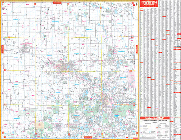
Scale 1:2,640. Size 67" W x 54" H. Laminated. The 4th edition Livingston County, Michigan Wall Map by Universal Map shows complete street detail. In addition, for your convenience, indexing is on the map's face. Provides up-to-date cartography with new streets and changes. Printed in color with a markable and washable laminated surface. Framing rails are included top and bottom for easy wall mounting. Boundaries as follows: North: To Shiawasee and Genesee Co. Line. South: To Washtenaw County line. East: To Oakland County line. West: To Ingham County Line. The special features and data are as follows: all streets, all highways, educational facilities, government buildings, shopping centers, hospitals, ZIP codes and boundaries, post offices, fire and police stations, airports, cemeteries, recreational parks, golf and country clubs, points of interest, city limits and Annexations, railroads, mileage circles, water features, range, township and section lines, block numbers, and longitude/ latitude lines. Railed wall maps can be turned into pull down maps on spring rollers for an additional $40.
Write Your Own Review