
$229.95
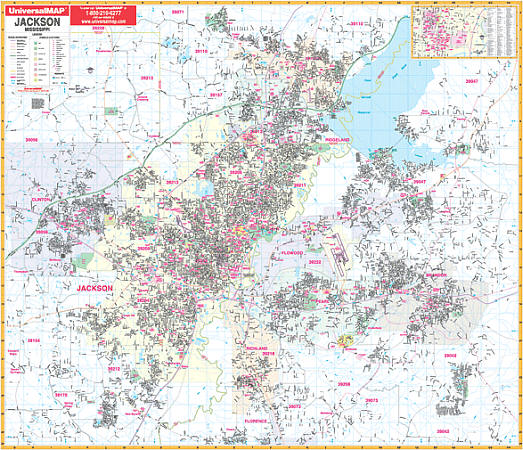
Scale 1:180,000. Size 54" W x 65" H. Laminated. Provides up-to-date cartography with color and a markable/washable-laminated surface. Cities indexed on map's face. Hanging rails mounted top and bottom. Includes all the following 9 counties: Copiah, Hinds, Leake, Madison, Rankin, Scott, Simpson, Smith, and Yazoo. Portions of the following counties: Attala, Claiborne, Covington, East Carroll LA, Holmes, Humphreys, Issaquena, Jasper, Jefferson, Jefferson Davis, Jones, Lawrence, Lincoln, Madison LA, Neshoba, Newton, Sharkey, Tenasas, Warren, Warren LA, Washington, and Winston. North: 50 miles to include Louise, Eden, and Goodman; South: 45 miles to include Fayette, Wesson, and Collins; East: 50 miles to include Sebastopol, and Sylvarena; West: 55 miles to include Fayette and Mayersville. Details include major streets and highways, airports, parks, county lines, mileage circles, longitude/latitude, water features, ZIP codes/boundaries, and points of interest. Railed wall maps can be turned into pull down maps on spring rollers for an additional $40.
Write Your Own Review