
$229.95
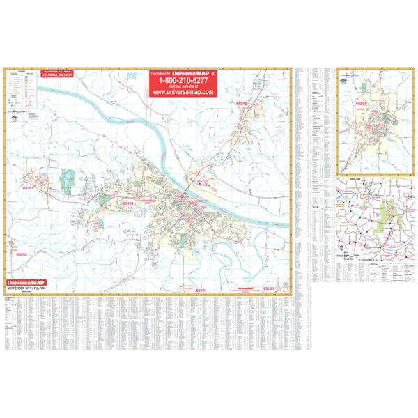
Scale 1:1,700. Size 70" W x 48" H. Laminated. Provides up-to-date cartography with new streets and changes. Printed in color with a markable/washable-laminated surface. Streets indexed in a separate book. Includes hanging rails mounted top and bottom. Area of coverage: North: includes the town of Mykee; South: to the town of Wardsville; East: to the town of Taox; West: includes the town of Lohman. Insets: State of Missouri map, localized area map, City of Fulton map. Details included: all streets/highways, water features, shopping centers, recreational parks, block numbers, zip codes/boundaries, government buildings, fire/police stations, educational facilities, golf/country clubs, city limits/annexations, range/township/section lines, longitude/latitude, airports, hospitals, railroads, post offices, cemeteries, mileage circles, and points of interest. Railed wall maps can be turned into pull down maps on spring rollers for an additional $40.
Write Your Own Review