
$249.95
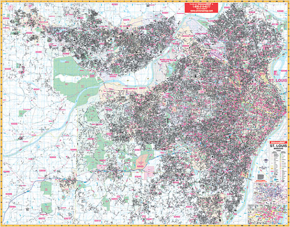
Size 76" W x 60" H. Laminated. The St. Louis, Missouri Wall Map by Universal Map and provides complete street detail with up-to-date cartography and all new streets and changes. The streets are indexed in a separate book. Printed in color on a laminated, markable/washable surface. The area of coverage includes all of St. Louis with the following borders: North: to St. Paul and all of St. Charles; South: to Arnold; East: to the Mississippi River; West: to Wentzville. Includes an inset map of Downtown St. Louis. Special features, data, and details: all streets and highways, government buildings, airports, golf courses and country clubs, railroads, longitude and latitude lines, shopping centers, recreation parks, mileage circles, cemeteries, educational facilities, hospitals, post offices, city limits and annexations, block numbers, longitude and latitude lines, township names, water features, fire and police stations, ZIP codes and boundaries, and miscellaneous points of interest. Railed wall maps can be turned into pull down maps on spring rollers for an additional $40.
Write Your Own Review