
$249.95
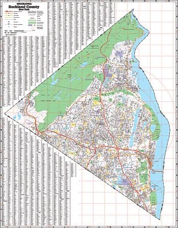
Scale 1:2,964. Size 54" W x 68" H. Laminated. Printed in color with a markable and washable-laminated surface. Streets indexed in a separate book. Includes hanging rails mounted top and bottom. Railed wall maps can be turned into pull down maps on spring rollers for an additional $40. The area of coverage includes all of Rockland County with the following boundaries: North: to the orange/Rockland County line; South: to the New Jersey State/Rockland County line; East: to the Westchester/Rockland County line; West: to the Rockland/Orange County line. Details: streets and highways, government buildings, airports, water features, educational facilities, railroads, recreational parks, golf and country clubs, post offices, hospitals, city limits and annexations, cemeteries, mileage circles, ZIP codes, longitude and latitude lines, and points of interest.
Write Your Own Review