
$229.95
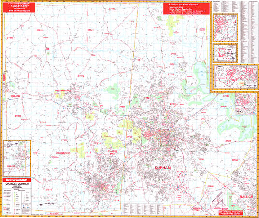
Size 62" W x 54" H. Laminated. The Orange & Durham Counties, North Carolina Wall Map by Universal Map includes up-to-date cartography, new streets and changes. Provides a laminated surface making the map both markable and washable. Includes street indexing that appears in a separate book. The area of coverage is as follows: North: Person County line; South: Chatham County line; East: Wake County line; West: Alamance County line. Map insets include Downtown Durham, Mabane, Duke University, University of North Carolina at Chapel Hill, and NCCU. Also includes all streets, post offices, hospitals, railroads, mileage circles, airports, cemeteries, shopping centers, water features, recreational parks, fire district lines, government buildings, fire and police stations, educational facilities, golf courses and country clubs, ZIP codes and boundaries, city limits and annexations, and miscellaneous points of interest. Framing rails are included on top and bottom for easy wall mounting. Railed wall maps can be turned into pull down maps on spring rollers for an additional $40.
Write Your Own Review