
$249.95
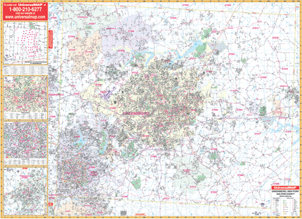
Scale 1:2,650. Size 71" W x 54" H. Laminated. The Greensboro, High Point, and Guilford County, North Carolina Wall Map by Universal Map. Printed in color with a markable/washable-laminated surface. Streets are indexed in a separate book. Includes hanging rails mounted top and bottom. Area of coverage--all of Guilford County with the following boundaries: North: to the Rockingham County line, including all of Stokesdale; South: to the Randolph County line, including all of Archdale in Randolph Co.; East: to the Alamance County line, including the city of Gibsonville; West: to the Forsyth County line, including a portion of Kernersville. Insets: include the city of Thomasville in Davidson County, Downtown High Point, Downtown Greensboro, and the University of North Carolina at Greensboro. Details are as follows: airports, post offices, hospitals, railroads, mileage circles, points of interest, block numbers, all streets and highways, cemeteries, shopping centers, water features, recreational parks, longitude and latitude lines, city limits and annexations, government buildings, fire and police stations, educational facilities, golf courses and country clubs, ZIP codes and ZIP code boundaries, and township names. Railed wall maps can be turned into pull down maps on spring rollers for an additional $40.
Write Your Own Review