
$229.95
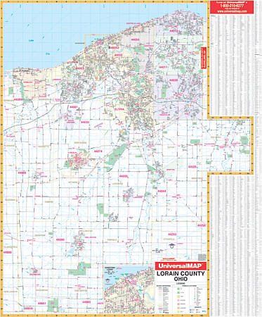
Size 42" W x 54" H. Laminated. Provides complete street detail with up-to-date cartography, new streets and changes, color with a markable and washable laminated surface. Indexed on map's face. Framing rails are included on top and bottom for ease in hanging. Area of coverage: all of Lorain County with the following boundaries: North: to Lake Erie; South: to the Lorain/Ashland County lines; East: to the Lorain/Cuyahoga County lines; West: to the Lorain /Erie/Huron County lines. Included is an inset map of Downtown Lorain. Details and information included: airports, cemeteries, hospitals, railroads, post offices, township names, all streets and highways, shopping centers, water features, recreational parks, mileage circles, city limits and annexations, government buildings, fire and police stations, educational facilities, golf courses and country clubs, ZIP codes and boundaries, longitude/latitude lines, and points of interest. Railed wall maps can be turned into pull down maps on spring rollers for an additional $40.
Write Your Own Review