
$249.95
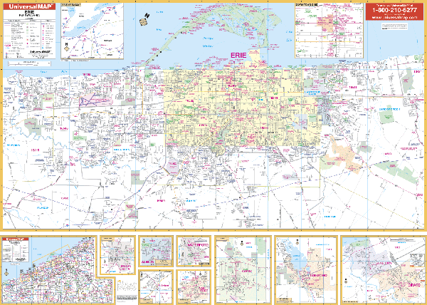
Scale 1:960. Size 63" W x 46" H. Laminated. The Erie, Pennsylvania Wall Map by Universal Map. Area of coverage ranges: North: to Lake Erie, including Presque Isle State Park; South: includes the I-90 and I-79 interchange, and Orchard Ponds Golf Course; East: to Harbor Creek and SR 531 and Depot Rd; West: includes Manchester Beach and Orchard Hills. Insets include: Albion, Corry, Edinboro, Fairview, Girard, Northeast Lake City, Union, Waterford, and Erie County. The special features and data are as follows: all streets and highways, government buildings, airports, golf courses and country clubs, railroads, longitude and latitude lines, block numbers, shopping centers, recreational parks, mileage circles, cemeteries, educational facilities, hospitals, post offices, city limits and annexations, water features, fire and police stations, and assorted points of interest. Framing rails are included on top and bottom for easy wall mounting. Railed wall maps can be turned into pull down maps on spring rollers for an additional $40.
Write Your Own Review