
$229.95
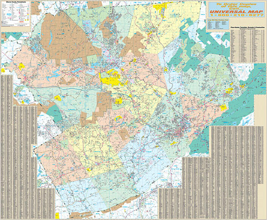
Scale 1:2,800. Size 70"x60". Laminated. The Poconos, Monroe County, Pennsylvania Wall Map by Accurate Maps. Printed in color with a markable/washable--laminated surface. Cities and towns are indexed on the face of the map. Framing rails are included on top and bottom for easy wall mounting. Railed wall maps can be turned into pull down maps on spring rollers for an additional $40. Area of coverage: All of Monroe County with the following boundaries: North: to the Pike County line; South: to the Northampton county line; East: to the New Jersey State line; West: to the Carbon County line. Details include all streets and highways, government buildings, airports, water features, mileage circles, shopping centers, educational facilities, hospitals, railroads, recreational parks, golf and country clubs, post offices, city limits and annexations, cemeteries, ZIP codes/boundaries, and points of interest.
Write Your Own Review