
$249.95
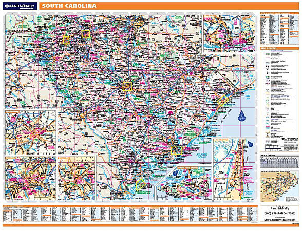
Scale 1:650,000. Size 66" W x 42" H. Laminated. Printed in color with a markable/washable-laminated surface. Cities and counties are indexed on the face of the map. Contains hanging rails mounted top and bottom. Special features include color-coded counties, a mileage chart between major cities, and insets of Columbia and Greenville. Details state and federal highways, interchanges and exit numbers, secondary roads, cities and towns, major airports, major waterways, state universities, military installations, state and national parks, wildlife areas, population classifications, and points of interest. Railed wall maps can be turned into pull down maps on spring rollers for an additional $40.
Write Your Own Review