
$249.95
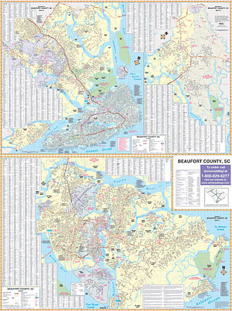
Size 48" W x 70" H. Laminated. The Hilton Head, Beaufort County, South Carolina Wall Map by Accurate Maps. Printed in color with a markable/washable--laminated surface. Cities and towns are indexed on the face of the map. Framing rails are included on top and bottom for easy wall mounting. Railed wall maps can be turned into pull down maps on spring rollers for an additional $40. Area of coverage: All of Beaufort County including: Beaufort, Hilton Head Island, Bluffton, St. Helena Island, Burton, Dale, Gardens Corner, Parris Island, Daufuskie Island, and Laurel Bay. Details include all streets and highways, government buildings, airports, water features, fire and police stations, shopping centers, educational facilities, hospitals, railroads, recreational parks, golf and country clubs, post offices, city limits and annexations, subdivision names, cemeteries, ZIP codes/boundaries, and points of interest.
Write Your Own Review