
$249.95
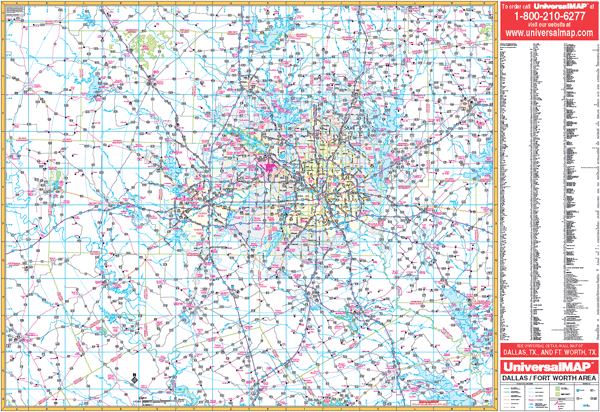
Scale 1:230,000. Size 66" W x 54" H. Laminated. Provides up-to-date cartography. Printed in color with a markable and washable laminated surface. Streets indexed on the face of the map. Includes hanging rails mounted top and bottom. Area of Coverage: Includes all of the following counties: Collin, Dallas, Denton, Ellis, Hood, Johnson, Kaufman, Parker, Rockwall, Somervill, Tarrant, and Wise. Includes portions of the following counties: Cooke, Fannin, Grayson, Henderson, Hill, Hunt, Montague, Navarro, and Palo Pinto. Boundaries are as follows: North: Includes Sherman, Denison, and Pottsboro in Grayson County; South: Includes Hillsboro in Hill County, Corsicana in Navarro County; East: includes Greenville in Hunt County; West: to Mineral Wells in Palo Pinto County. Details US and State highways, county roads, airports, military installations, water features, railroads, ZIP codes/boundaries, and national forests. Railed wall maps can be turned into pull down maps on spring rollers for an additional $40.
Write Your Own Review