
$249.95
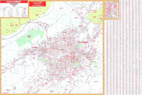
Size 76" W x 54" H. Laminated. Roanoke and Salem, Virginia with adjacent areas is a Wall Map by Universal Map measuring 76" W x 54" H. Contains up-to-date cartography with new streets and changes in complete street detail. Printed in color with a durable, laminated surface that is both markable and washable. Street indexing is found on the face of the map. The area of coverage is as follows: North: to include Mt. Union in Botetourt County; South: to the Franklin County line just south of Willow Branch Road; East: into Bedford County including the Blue Ridge Parkway; West: to Montgomery and Craig County lines including Berrybrook Dr. Included is an inset map of Downtown Roanoke. The special features and data are as follows: all streets and highways, government buildings, airports, golf courses and country clubs, railroads, longitude and latitude lines, ZIP codes and ZIP code boundaries, shopping centers, recreational parks, mileage circles, cemeteries, educational facilities, hospitals, post offices, city limits and annexations, fire/police stations, and points of interest. Framing rails are included on top and bottom for easy wall mounting. Railed wall maps can be turned into pull down maps on spring rollers for an additional $40.
Write Your Own Review