
$17.95
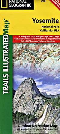
Scale 1:80,000. Size 25"x37". Trails Illustrated edition. Printed on waterproof, tear-resistant, lightweight, plastic synthetic paper. Coverage includes: Stanislaus National Forest, Toiyabe National Forest, Inyo National Forest, Sierra National Forest Emigrant Wilderness, Carson Iceberg Wilderness, Hoover Wilderness, Yosemite Wilderness, and Ansel Adams Wilderness with detail on Yosemite Valley and Tuolumne Meadows. Also provides UTM grids for use with your GPS unit.
Write Your Own Review