
$249.95
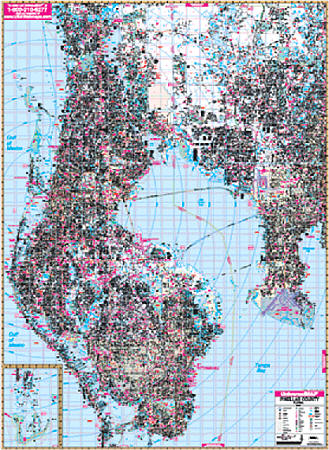
Scale 1:2,640. Size 77"x 54". Laminated. The 6th edition Pinellas County, Florida Wall Map by Universal Map measures 54" x 77" (4'6" W x 6'5" H) and is printed in color with a laminate surface which is markable and washable. Provides complete street detail with up-to-date cartography showing new streets and changes. Streets are indexed in a separate book. Framing rails are included on top and bottom for easy wall mounting. Boundaries as follows: North: to the Pasco County line; South: to the Gulf of Mexico; East: includes Hillsborough County to US41 with McDill Air Force Base and Tampa International Airport; West to the Gulf of Mexico. Special features and data are as follows: all streets and highways, government buildings, ZIP codes and ZIP code boundaries, airports, golf courses and country clubs, water features, city limits and annexations, township-section-and range lines, post offices, shopping centers, cemeteries, points of interest, mileage circles, block numbers, educational facilities, fire and police stations, hospitals, recreational parks, subdivision names on map, and railroads. Railed wall maps can be turned into pull down maps as a $40 option.
Write Your Own Review