
$17.95
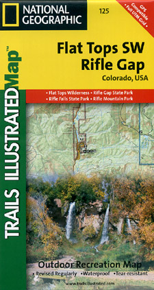
Scale 1:41,000. Size 22"x32". The Flat Tops SW/Rifle Trails Illustrated map is the most comprehensive recreational map for this beautiful area in western Colorado. Coverage includes: White River National Forest; Grand Hogback; and the Rifle Gap and Rifle Falls State Recreation Areas; Rifle Mountain Park; and the city of Rio Blanco. Also includes Rifle Gap Reservoir, Rifle Creek, and Meadow Lake.
Write Your Own Review