
$17.95
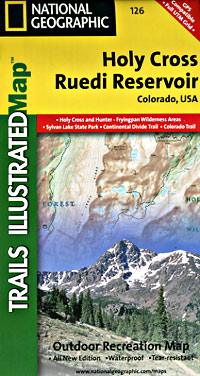
Scale 1:41,000. Size 22"x32". The Holy Cross/Ruedi Reservoir Trails Illustrated map is the most comprehensive recreational map for this beautiful area in the mountains of Colorado. Coverage includes: White River and San Isabel National Forests; Hunter-Fryingpan and Holy Cross wilderness areas; Sylvan Lake state recreation area; cities of Thomasville and Meredith; Turquoise Lake; Rocky Fork Creek; Ruedi Reservoir; Crooked Creek, Fancy, Hagerman, Half Moon, Fall Creek and Missouri passes; 10th Mountain Huts: Margys Hut, Harry Gates Hut, Peter Estin Hut, Betty Bear Hut, Skinner Hut, Uncle Buds Hut, 10th Mountain Memorial Hut, Notch Mountain Hut.
Write Your Own Review