
$17.95
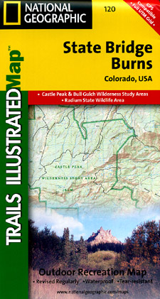
Scale 1:41,000. Size 22"x32". The State Bridge/Burns Trails Illustrated folded map is your essential guide for outdoor exploration in Colorado's State Bridge/Burns area. Coverage includes White River National Forest; Congor Mesa, Bond, Radium, McCoy, Burns segments of the Colorado and Piney rivers; Castle Creek Ponds; and Muddy Creek Pass.
Write Your Own Review