
$249.95
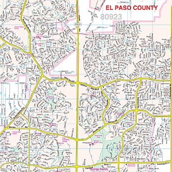
Our Colorado Springs, CO Wall Map, with adjacent areas, measures 59" x 72" (4'11" W x 6' H) and features up-to-date cartography, with new streets and changes in complete street detail; is printed in color, with a markable and washable laminated surface; and offers a street index in a separate book-format.
The area of coverage includes the following boundaries:
- North to two miles north of the El Paso-Douglas County line
- South to Fort Carson and Fountain
- East to two miles past Colorado Springs and Antler Creek Golf Course
- West to Green Mountain Falls and the El Paso County line
Details and features include:
- AIRPORTS
- BLOCK NUMBERS
- CEMETERIES
- CITY LIMITS
- EDUCATIONAL INSTITUTIONS
- GOLF & COUNTRY CLUBS
- GOVERNMENT BUILDINGS
- HOSPITALS
- POINTS OF INTEREST
- POLICE STATIONS
- RAILROADS
- RECREATIONAL PARKS
- SHOPPING CENTERS
- STREETS & HIGHWAYS
- WATER FEATURES
- ZIP CODE BOUNDARIES
Framing rails are included, top and bottom, for easy wall mounting. Spring roller mounting is also available, for an additional $40.
Write Your Own Review