
$249.95
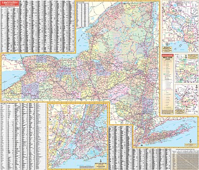
The 3rd edition State of New York Wall Map by Kappa Map Group measures 60” W x 52” H (5' W x 4'4" H) using up-to-date cartography at a scale of 1” = 7 miles. Printed in color with a markable/washable-laminated surface. Cities and counties are indexed on the face of the map. Includes hanging rails mounted top and bottom.
Features color-coded counties and a mileage chart between major cities. Details all state and federal highways, secondary roads, cities and towns, major airports, major waterways, state universities, military installations, state/national parks, wildlife areas, and points of interest.
Railed wall maps can be turned into pull down maps on spring rollers for an additional $40.
Write Your Own Review