
$16.95
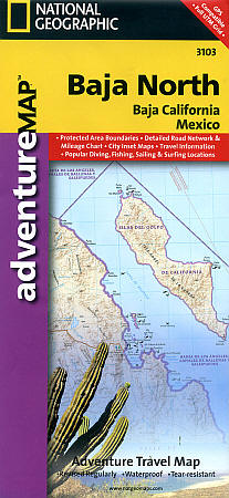
Scale 1:450,000. Size 25"x38". National Geographic edition. New National Geographic's Baja California and Baja California Sur Adventure Maps combine detailed terrain with local information ideal for more adventurous travelers. Together the two maps cover the entire Baja peninsula and include detailed insets of Tijuana, Mexicali, Ensenada, La Paz, San Jose Del Cabo, Cabo San Lucas, and the Cabo Resort Corridor. Like all National Geographic Adventure Maps, our new Baja titles are printed on durable waterproof-tear-resistant material which is designed to stand up to whatever conditions you encounter on the road.
Coverage Highlights: Federally Protected Areas, including Parks and Reserves: Provided by the Nature Conservancy of Mexico; Detailed Road Network, Ferry Routes, and Mileage Charts; UNESCO World Heritage Sites; Historic Mission Locations; Popular Diving, Surfing, Fishing, Snorkeling, Whale Watching, and Scenic Viewpoint Locations; Detailed terrain with Shaded Relief; Useful Travel Information
The Baja California North map covers the entire State of Baja California, the northernmost half of the Baja California Peninsula. Our complimentary Baja South map covers, Baja California Sur, the second and southernmost Mexican State on the peninsula.
Write Your Own Review