
$17.95
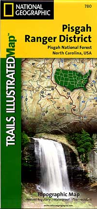
Scale 1:45,000. Size 26"x38". Trails Illustrated edition. Printed on waterproof, tear-resistant, paper-like plastic. This Trails Illustrated topographic map is the most comprehensive recreational map for North Carolina's Pisgah Ranger District area. Coverage includes Pisgah National Forest; Shining Rock and Middle Prong wilderness areas; Bent Creek Research and Demonstration Forest; North Carolina Arboretum; Blue Ridge Parkway; Mountains-to-Sea Trail; Looking Glass Rock; Cold Mountain; Sliding Rock and Mount Pisgah recreation areas; Looking Glass Falls; and the Cradle of Forestry in America National Historic Site.
Write Your Own Review