
$17.95
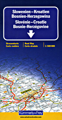
Scale 1:500,000. Size 36"x51". Kummerly + Frey edition. Indexed. English and multilingual legends. This is a big spectacular map. Includes a tremendous amount of information. Shows major roads, secondary roads, road numbers, roads with gradients of more than 15%, toll roads, railways, cable cars, airports, political boundaries, nature reserves and national parks, passes, car ferries, shipping lanes, distances between points in kilometers, holiday villages, spas, cathedrals, churches, mosques, castles, palaces, ancient monuments, ruins, waterfalls, museums, tourist sites, panoramic views, lighthouses, restaurants and snack bars on motorways, petrol stations, motels, isolated hotels, inns, camping sites, and frontier crossings. Laminated card cover. English and multilingual legends.
Write Your Own Review