
$38.95
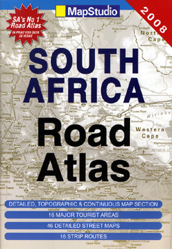
2011 Edition! Various scales. Size 8?"x12". 140 pages. Fully indexed. Map Studio edition. Softcover, saddle-stitched. Shows all types of roads, road numbers, distances between points in kilometers, mountain passes, railways, cities, towns, villages, airports, international and provincial boundaries, rivers, lakes, canals, national parks, nature reserves, rest camps, places of interest, historical sites, border controls, heights in meters, marshes, and waterfalls. Also includes distance tables, full-color photographs, eight route maps between major metropolitan areas, plus large-scale blowup maps of 11 special tourist areas such as the Kruger National Park, and the Winelands, and detailed city street plans of Durban, Cape Town, East London, Johannesburg, Nelspruit, Pietermaritzburg, Port Elizabeth, and Pretoria, all at 1:20,000. Beautiful clear cartography. This is a great atlas! 2011 edition! BIG > SAMPLE MAP
Write Your Own Review