
US Canada Border Road and Physical Travel Reference Map America.
$17.95
In stock
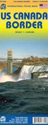
Scale 1:2,500,000. International Travel Maps edition.
ITMB is renowned for releasing innovative titles that have never been done before. Not only are most of our country maps unique, in that no other publisher bothers to do them, so with North America we’re experimenting with maps that either have never been done before, or have been done without due thought. Thus we have released the first serious travel atlas to historic Route 66, a new highways atlas to the entire Alaska/Yukon/NWT region (another first, never before attempted).
Now we have completed a map that is long overdue. The Canadian/US border is the longest single border in the world between two countries. It stretches from the southern end of Vancouver Island eastward to Nova Scotia/New Brunswick, has dozens upon dozens of border crossings and stretches for about 5,000 kilometers or is it miles? Regardless, it is long, but more importantly, since 1815, it has been promoted as the longest ‘undefended’ border in the world. Naturally, there is a strict border patrol/surveillance on both sides of the border area, but there are no troops, no navy, no air force operations on either side. It is unprecedented in world history to have such a long border, free of military supervision. This map is double-sided and shows the border states and their provincial counterparts, starting with British Columbia and Washington/Idaho/Montana for about 150 miles on either side of the actual border, and carries on eastward through the Prairie/Midwest region, before dipping south to encircle the Great Lakes region, before terminating with New York City at the southern extreme and most of New Brunswick/Maine in the northeast.
The purpose of the map is to show the true nature of a region where more than 100,000,000 people live; the highways binding them together, the major cities as insets (Long Island, Boston region, Chicago,Toronto central, Seattle, Vancouver, and Victoria), the many border crossings and the artificiality of the border. This is a map showing how easy it is to travel from North Dakota to Manitoba (for instance), or how easy it is to make a Great Lakes round trip. This map spans a continent and follows the route taken by my ancestor, Alexander Mackenzie, who first crossed the continent in 1793 on foot and mapped the routes followed by all settlers heading westward for the next century, including those Johnny-come-latelies Lewis and Clark, who only followed well-trodden trapping routes made by the Northwest Fur Company traders a generation earlier.
| Item Price | $17.95 |
|---|
Write Your Own Review