
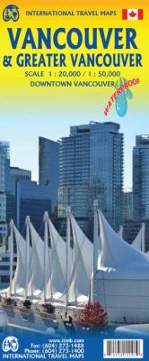
Vancouver and Greater Vancouver Road and Physical Travel Reference Map British Columbia, Canada.
Scale 1:20,000/1:50,000. Size 27"x39". International Travel Maps edition.
This is the latest and most up-to-date map of Vancouver on the market. When I first opened ITMB in 1980, there were 13 (that’s right, thirteen!) different firms publishing maps of Vancouver, most of them local firms.
Today, ITMB is the only local firm left! We’re fortunate in that updating our artwork for both the city side of the map and the wider Vancouver regional side of the map is fairly easy, as we’re here. We do update with each printing, and we keep our print runs fairly small, to ensure that new editions come out every couple of years.
This edition shows the new rapid transit line to Coquitlam (opening December 2016) and the growing network of bike routes that are creating hardships for vehicle drivers (cyclists don’t care). The map is again printed on waterproof paper, which for Vancouver has practical applications apart from durability. We do live in a rain forest, after all!
The front cover shows our ‘sails’ gracing our harbour, taken from the tenth deck of the last cruise ship we took from Vancouver. The back cover shows our growing ‘Skytrain’ rapid transit system, and yes, ITMB is on the map in Richmond, close to the river.
| Item Price | $17.95 |
|---|