
Massachusetts Road Maps | Detailed Travel Tourist Driving
|
Massachusetts Road Maps |
Massachusetts
- $12.95
Item Code : JIMP10114
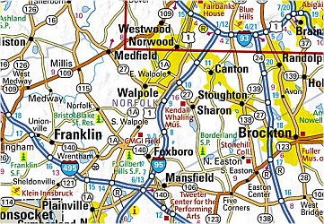
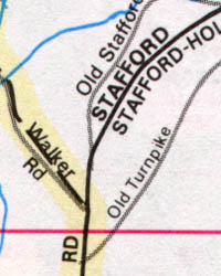
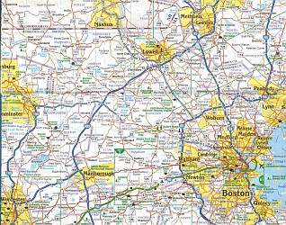 Scale 1:349,000. Size 26"x38". Jimapco edition. This is our largest-scale map of Massachusetts.
 - $16.95
Item Code : NATL10117

 Scale 1:600,000. Size 18"x25". National Geographic edition. The front side features insets of Lowell, Downtown Boston, Worcester, Springfield, Providence (Rhode Island), New Bedford/Fall River. The back includes: Map and information for Boston; Information for Cape Cod National Seashore; Points of interest; Scenic drives; Park Service sites in Massachusetts.
 - $10.95
Item Code : AMER10119

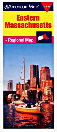
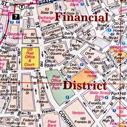
 Scale 1:350,000. Size 23"x34". American Map Company edition. The Massachusetts State fold map is a full-color, regional map, including: Brockton, Fall River, Lawrence, Lowell, New Bedford, Springfield, and Worcester.
 - $12.95
Item Code : JIMP21153

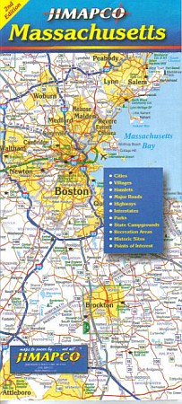
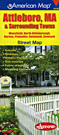
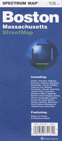
 Size 25"x38". Jimapco edition. Road map of the state of Massachusetts. Includes cities, villages, hamlets, major roads, highways, interstates, parks, state campgrounds, recreation areas, historic sites, and points of interest. Includes expanded maps of Greater Boston, downtown Boston, the 495 corridor from Newburyport to Lowell, Brockton, New Bedford, Fall River and Greater Springfield. Fully indexed for communities and points of interest. Turnpike mileage chart included.
 - $10.95
Item Code : AMER10120
 Scale 1:360,000. Size 23"x36". American Map Company edition.
 - $11.95
Item Code : RAND22844
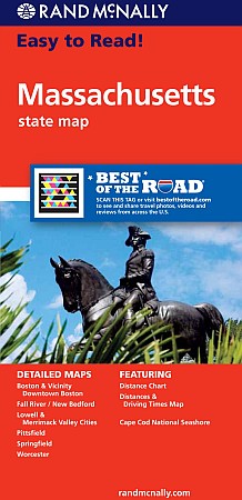 Rand McNally Maps edition. Detailed road map of Massachusetts. Includes inset maps of Boston & Vicinity, Downtown Boston, Cape Cod National Seashore, Lowell/Lawrence, New Bedford/Fall River, Springfield, and Worcester. Map size is 28 x 40 inches unfolded.
 - $29.95 + $7.50 p&h or $28.50 foreign delivery
Item Code : DELR10123
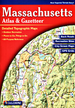
 Scale 1:82,000. Full size, 11"x15?". 80 pages. DeLorme Publishers edition. Designed for those who want to get off the beaten path, this atlas shows all types of roads and tracks, cities, towns, hamlets, and provides topographic maps that show hiking trails, campgrounds, fishing spots, ski areas, and more. Contains a guide to state and national parks and recreation areas, historic sites, and unique natural areas. Comprehensive index enables the user to find locations quickly and easily. Great for car or backpack! Saddle-stitched, durable laminated paper cover.
 - $24.95 + $7.50 p&h or $28.50 foreign delivery
Item Code : JIMP10124
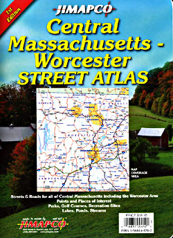
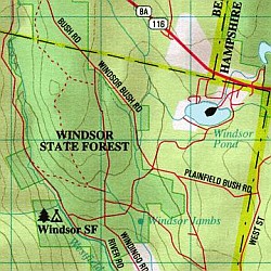
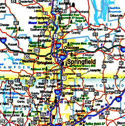 Scale 1:33,000. Size 9"x12". 159 pages. Jimapco edition. Spiral bound atlas of the streets & roads for all of Central Massachusetts centering on the Worcester area, and including portions of Franklin, Hampden, Middlesex and Norfolk Counties. You will find points and places of interest, parks, golf courses, recreation sites, lakes, ponds, and streams.
 - $36.95 + $7.50 p&h or $28.50 foreign delivery
Item Code : AMER10129
 "Various scales". Size 10"x14". 168 pages. American Map Company edition.
 - $259.00 Shipped rolled in a tube + $24.80 p&h or $56.80 foreign delivery
Item Code : RAND10131
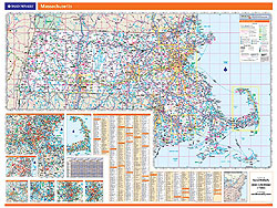
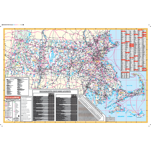
 Scale 1:222,000. Size 46"x60". Rand McNally edition. Laminated. Professional Grade. Rand McNally's regional wall map of Massachusetts is ideal for anyone needing a comprehensive representation of the area for planning, routing, or reference. It's a great choice for business and sales strategy, urban development, social work outreach, education, and marketing. Massachusetts residents, businesses, and government offices are sure to find this wonderful reference tool irreplaceable. ?The laminated wall map is printed with UV-resistant ink to help prevent color fading. ?Map details include state highways, federal highways, county highways, county boundaries, city shading, cities and towns, major waterways, state/national parks, campsites, exit numbers, rest areas, military installations, airports, golf courses, universities, and much more. ?You'll also find a city/county index on the map, Rand McNally Express Access Codes for more information online, and a driving times map between major cities in the region. ?This truly complete wall map even includes a hanging kit with rails for easy mounting just about anywhere. Inset maps include: Boston; Boston Downtown; New Bedford/Fall River; Lowell/Lawrence; Springfield; Worcester; and Cape Cod National Seashore.
 - $249.95 + $24.80 p&h (add $40 for spring rollers)
Item Code : UNIV10132
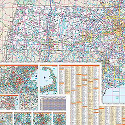
 Size 60" W x 42" H. Laminated. Printed in color with a markable/washable-laminated surface. Cities and counties are indexed on he face of the map. Mounted with hanging rails top and bottom. Features color-coded counties and a mileage chart between major cities. Details include all state highways, all federal highways, cities, major waterways, major airports, towns, state parks, wildlife areas, hospitals, military installations, and points of business. Framing rails are included on top and bottom for easy wall mounting. Railed wall maps can be turned into pull down maps on spring rollers for an additional $40.
 - $10.95
Item Code : AMER10135
 Scale 1:33,000. Size 32"x39". American Map Company edition.
 - $10.95
Item Code : AMER10136
 Scale 1:39,000. Size 26"x40". American Map Company edition.
 - $13.95
Item Code : BERN10140
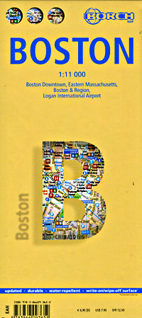
 Scale 1:11,000. Size 20"x26". Indexed. Berndtson & Berndtson edition. Printed on both sides. English and multi-lingual legends. Laminated, waterproof, easy-fold, flexi-map.
 - $17.95
Item Code : ITMB10141
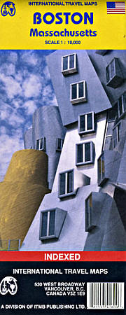
 Scale 1:10,000. Size 27"x37". International Travel Maps edition. Indexed. English text and legends. Easy-to-read cartography. Includes considerable useful travel information.
 - $10.95
Item Code : MEAS10143
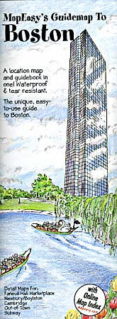
 Scale 1:6,000. Size 18"x27". Map Easy edition. Perfect for the intrepid or armchair traveller, this charming map combines the best of a guidebook and a location map, all in one. The map is color coded to include information about the city's hotels, restaurants, shops, and sites. Printed on tear-proof, water-resistant, lightweight, paper-like plastic, that is incredibly durable. Also includes sketches of the landscape and interesting details about the area. You'll love this map!
 - $10.95
Item Code : RAND10144
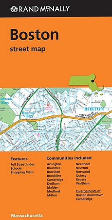
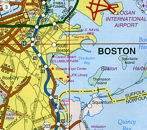
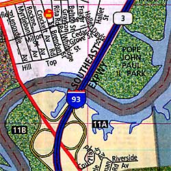 Scale 1:23,000. Size 36"x45". Rand McNally edition. Detailed city street map. Rand McNally's folded map for Boston is a must-have for anyone traveling in and around this part of Massachusetts, offering unbeatable accuracy and reliability at a great price. Our trusted cartography shows all Interstate, U.S., state, and county highways, along with clearly indicated parks, points of interest, airports, county boundaries, and streets. The easy-to-use legend and detailed index make for quick and easy location of destinations. You'll see why Rand McNally folded maps have been the trusted standard for years.
 - $10.95
Item Code : UNIV10145
 Scale 1:30,000. Size 28"x40". Universal Map edition.
 - $16.95
Item Code : NATL21068
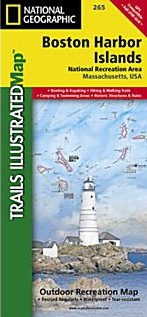
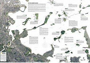 Scale 1:30,000. Size 26"x38". National Geographic edition. Our new detailed recreation map for the Boston Harbor Islands National Recreation Area is a two-sided, waterproof map which covers all 34 of the harbor islands plus shoreline parks, downtown Boston, access and ferry interpretive information and neighboring communities. The front side contains both bathymetry and topography—making it the perfect multi-functional map for kayaking, hiking, fishing, wildlife viewing and more. This beautiful map is a perfect souvenir to remember your trip to the park as well as a highly functional tool for those that recreate here frequently. Users will find clearly marked ferry terminals and routes, water taxi stops, boat ramps, moorings, beaches, historic sites, campgrounds, trails, forts, and hundreds of place names. A UTM and Latitude/Longitude grid, as well as compass rose, scale bar, and marine navigation markers (buoys, lights, and soundings) will keep you pointed in the right direction.
 - $10.95
Item Code : VDAM22846
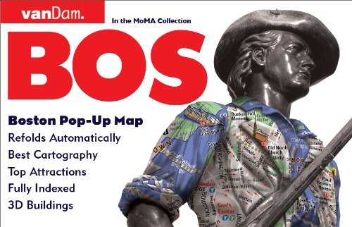
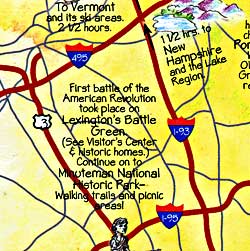
 Van Dam Maps edition. VanDam's best selling Boston Pop-Up maps all of Boston's attractions, neighborhoods, museums, hotels and more in our new easy to unfold format. Includes detailed maps of Metro Boston, The Freedom Trail, and Boston's transit system. This compact map package refolds easily to 3.75" x 6" (8.5" x 11" open) and fits discreetly in your shirt pocket. Complete street index and Manhattan subway map make navigating Beantown easy.
|
Massachusetts Road Maps |
