
Las Vegas Street Map | Detailed, Travel, Tourist, City
|
Las Vegas City Street Maps |
Las Vegas
- $10.95
Item Code : RAND11032
 "various scales". Size 28"x40". Rand McNally edition.
 - $10.95
Item Code : RAND11033
 Scale 1:33,000. Size 28"x39". Rand McNally edition.
 - $10.95
Item Code : NORT11045
 Various scales. Size 18"x32". North Star edition.
 - $17.95
Item Code : ITMB11035
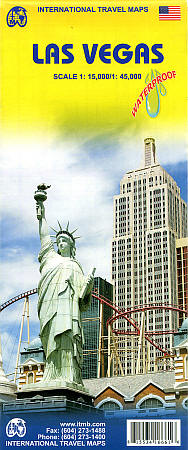
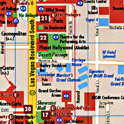
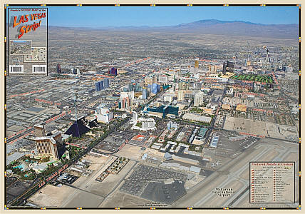
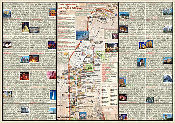
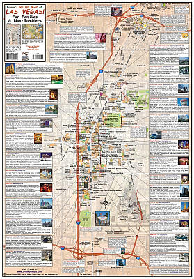
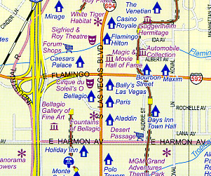 Scale 1:15,000. Size 27"x39". International Travel Maps edition. The Strip’ not only refers to a burlesque dance but to the pedestrian haven in Las Vegas that entrances and titillates millions of visitors every day. The world’s largest travel destination is Las Vegas, not London or Paris. That’s right, SIN CITY and proud of it, Vegas is one of the modern marvels of total entertainment anywhere in the world – and now ITMB has mapped it as it’s never been seen before. Take the Strip, that stretch of Las Vegas Boulevard from the Mandalay Bay to the venerable Lady Luck, and map it – showing each resort, event center (oops, center), monorail, and hotel. Add in surrounding attractions and shopping areas, and you have the central portion of this great city covered. The other side goes from the western beltway to Nelles air force base and from the city limits south to McCarron Airport, fully indexed.
 - $17.95
Item Code : BORC11034

 Scale 1:20,000. Size 20"x26". Borch edition. Indexed. Printed on both sides. English and multilingual legends. Laminated, water proof, easy-fold, flexi-map.
 - $16.95
Item Code : NATL11038
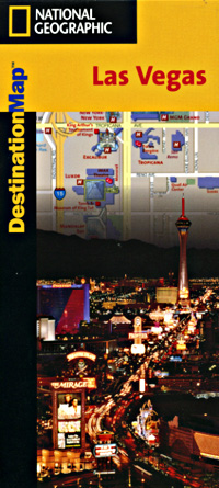
 Scale 1:21,000. Size 18"x25". National Geographic edition.
 - $10.95
Item Code : MEAS11039
 Scale 1:11,000. Size 18"x27". Map Easy edition. Perfect for the intrepid or armchair traveller, this charming map combines the best of a guidebook and a location map, all in one. The map is color coded to include information about the city's hotels, restaurants, shops, and sites. Printed on tear-proof, water-resistant, lightweight, paper-like plastic, that is incredibly durable. Also includes sketches of the landscape and interesting details about the area. You'll love this map!
 - $12.95
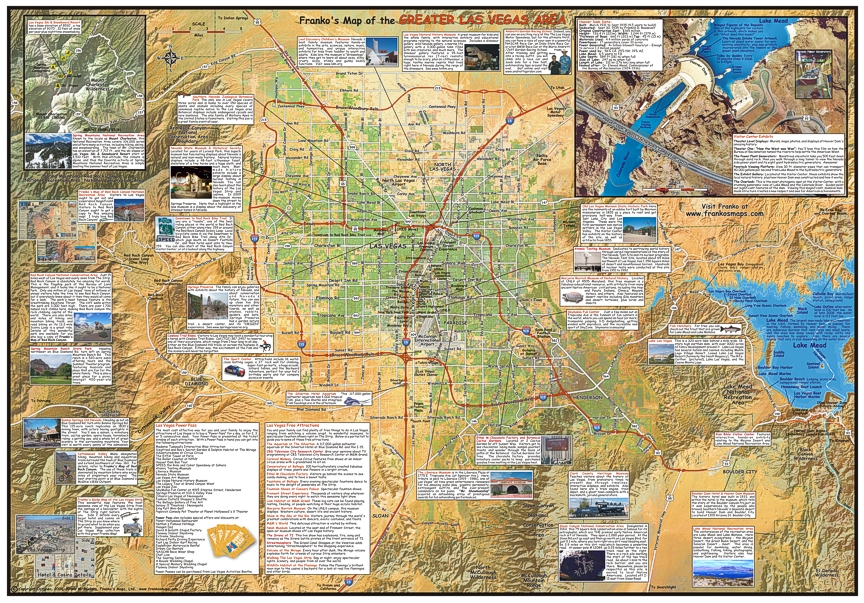
Item Code : FRKO11042
 Size 18?"x26?". Franko maps edition. Laminated. Get this map before you book your trip's reservations. Learn where all attractions are, hotels and transportation (airport, monorail and cabs). Use it to plan your events, walk abouts and reunions.Printed on wine otherdrinks resistant, so you may use it inside.
 - $12.95
Item Code : FRKO11043
 Size 18?"x26?". Franko maps edition. Laminated.
 - $249.95 + $24.80 p&h (add $40 for spring rollers)
Item Code : UNIV11041
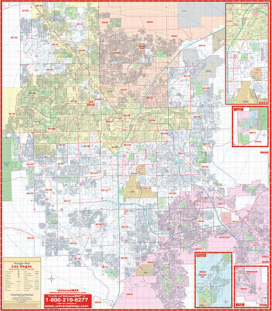 Scale 1:2,413. Size 50" W x 67" H. Laminated. The Las Vegas, Nevada Wall Map includes adjacent areas. Provides up-to-date cartography with new streets and changes. Printed in color with a markable and washable laminated surface. Hanging rails are mounted top and bottom. Area of coverage: North: including N. Las Vegas, Sunrise Manor, Nellis AFB, Las Vegas Motor Speedway, Floyd Lamb State Park; South: to Henderson; East: to East Las Vegas and Henderson; West: to Spring Valley, and western Las Vegas city limits 3 miles west of Las Vegas Beltway. Includes insets of Blue Diamond, Lake Las Vegas, and Boulder. Details include: airports, cemeteries, hospitals, railroads, post offices, zip codes/boundaries, all streets/highways, shopping centers, recreational parks, block numbers, government buildings, fire/police stations, educational facilities, golf/country clubs, city limits/annexations, section/twp/range lines, and points of interest. Railed wall maps can be turned into pull down maps on spring rollers for an additional $40.
 - $10.95
Item Code : RAND11044
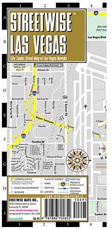
 Scale 1:35,000. Size 28"x40". Rand McNally edition. StreetWise Maps are incredibly durable laminated maps that are thoroughly detailed and also quite easy to read. This accordion-style map of Las Vegas is pleated to give the map an instantly engaging display that tucks neatly away to fit into your pocket, purse, briefcase, or even day planner.
 - $10.95
Item Code : RAND11046
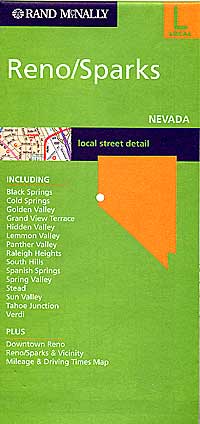
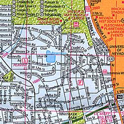 Scale 1:38,000. Size 25"x36". Rand McNally edition.
 - $10.95
Item Code : RAND11048
 Scale 1:63,000. Size 28"x40". Rand McNally edition.
 - $249.95 + $24.80 p&h (add $40 for spring rollers)
Item Code : UNIV11047
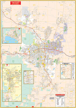 Scale 1:2,000. Size 54" W x 77" H. Laminated. Provides up-to-date cartography with new streets and changes. Printed in color with a markable and washable laminated surface. Includes a separate index book. Provided with hanging rails mounted top and bottom. Boundaries as follows: North: to include Cold Spring Valley and Reno-Stead Airport; South: to Washoe City at Little Washoe Lake; East: to Rainbow Bend and Lockwood at Exit 22 of I-80; West: to Verdi at Exit 1 of I-80. Map insets include Incline Village, Carson City (Includes Sunridge and Indian Hills) Downtown Reno, and a Western Nevada Area Map. There is also an overlay grid that is compatible with Sagebrush Street Guide Map Book with both pages and grids. The special features and data contained on this map are as follows: all streets, government buildings, airports, golf courses and country clubs, railroads, all highways, shopping centers, post offices, cemeteries, points of interest, mileage circles, educational institutions, hospitals, fire and police stations, recreational parks, city limits and annexations, longitude/latitude lines, block numbers, ZIP codes/boundaries, and water features. Railed wall maps can be turned into pull down maps on spring rollers for an additional $40.
|
Las Vegas City Street Maps |
