
$249.95
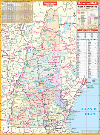
Scale 1:30,300. Size 40" W x 53" H. Laminated. The first edition State of New Hampshire Wall Map by Universal Map. Provides a laminated surface that is both markable and washable. Includes hanging rails mounted top and bottom. Indexed on the face of the map. Features a mileage chart between major cities; indexing of counties, cities, town, and places of interest; and also color-coded counties. Details include all state/federal/toll highways, major waterways, military installations, ski areas, state universities, rest areas, major airports, cities/towns, state parks, exit numbers, and points of interest. Railed wall maps can be turned into pull down maps on spring rollers for an additional $40.
Write Your Own Review