
Georgia South WALL Map, America.
$249.95
In stock
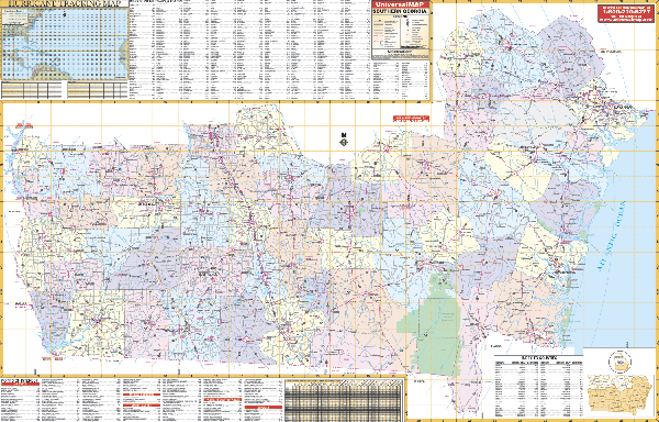
Scale 1:420,000. Size 62" W x 42" H. Laminated. Provides hanging rails mounted top and bottom. Area of coverage: North: to Quitman, Lee, Crisp, Wilcox, and Jeff Davis Counties; Northeast: to Chatham, Effingham, Bulloch, and Candler Counties; South: to Florida State line; East: to the Atlantic Ocean; West: to the Alabama State line. Features all 57 counties in southern Georgia; color-coded counties; mileage chart between major cities, hurricane tracking chart. Details interstates, US and State highways, county roads, longitude/latitude, airports, recreational areas, colleges, hospitals, military installations, water features, parks/national forests, and points of interest. Railed wall maps can be turned into pull down maps on spring rollers for an additional $40.
Scale 1:420,000. Size 62" W x 42" H. Laminated. Provides hanging rails mounted top and bottom. Area of coverage: North: to Quitman, Lee, Crisp, Wilcox, and Jeff Davis Counties; Northeast: to Chatham, Effingham, Bulloch, and Candler Counties; South: to Florida State line; East: to the Atlantic Ocean; West: to the Alabama State line. Features all 57 counties in southern Georgia; color-coded counties; mileage chart between major cities, hurricane tracking chart. Details interstates, US and State highways, county roads, longitude/latitude, airports, recreational areas, colleges, hospitals, military installations, water features, parks/national forests, and points of interest. Railed wall maps can be turned into pull down maps on spring rollers for an additional $40.
| Item Price | $249.95 + $24.80 p&h (add $40 for spring rollers) |
|---|
Write Your Own Review