
Balkans Road Maps | Detailed Travel Tourist Driving
Use our Maps to explore the culture of 7 countries all at once – Go Balkans.
Balkans is a combination of many countries which either share the common border or create an enclosed space which has been named as Balkans. The countries include Albania, Bosnia, Bulgaria, Croatia, Kosovo, Macedonia, Moldova, Montenegro, Romania and Serbia. There are a total of 9 languages which are spoken in Balkans which is Albanian, Bosnian, Bulgarian, Croatian, Macedonian, Montenegrin, Romanian, Serbian and Turkish.
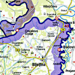
The total area of this country is nearly 6, 66,700 km sq, wherein you can explore the activities famous in all of these countries. Since it is an archipelago, here the activities include which you can explore with our maps can be climbing Haila Summit which is 2403 m above the sea level. You can go ahead and explore the countries which hosted winter Olympics that is Bosnia and Herzegovina. You can explore skiing in Serbia. Apart from these there are many other activities which can be explored at the fullest with our user-friendly maps which will provide you information on travel routes, roads, historical places and other landmarks, in spite of these you can also use our very friendly map to decide whether you should travel via land, air or water to the nearby location as their routes are mentioned clearly on the map via different highlighted colored lines, which can be interpreted easily by anyone.
The wildlife of Balkans includes mostly terrestrial species of animals which can be explored and enjoyed in the nearby national parks. Marine life is not that much in this city. People go for land routes in comparison to the water routes reason being the water cannot be predicted so easily in a city like this. The mountains on the Bulgarian sides are full of snow and provide scenic landscape. Trust me, the maps can make your trip more enjoyable. Probably to an extent where you may want to enjoy your next trip only with the map.
Balkans Road Maps for Tourists and TravelersDetailed Road Map of BalkansBuy travel maps for Balkans tourist attractions, road trips, street guide, driving directions and more |
Balkans
- $17.95
Item Code : FREY5359
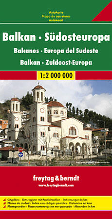
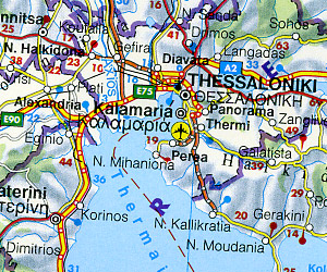 Scale 1:2,000,000. Size 35"x40". Indexed. Freytag-Berndt edition. Includes Slovenia, Croatia, Bosnia-Herzegovina, Serbia, Montenegro, Albania, Macedonia, and Kosovo.
 - $12.95
Item Code : CART5364
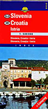
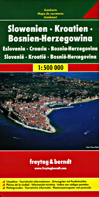
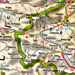 Scale 1:500,000. Size 26"x39". Indexed. Cartographia edition. English and multilingual legends. Beautiful shaded relief.
 - $17.95
Item Code : FREY5363
 Scale 1:500,000. Size 39"x46". Freytag-Berndt edition. Indexed. English and multilingual legends.
 - $17.95
Item Code : FREY5362
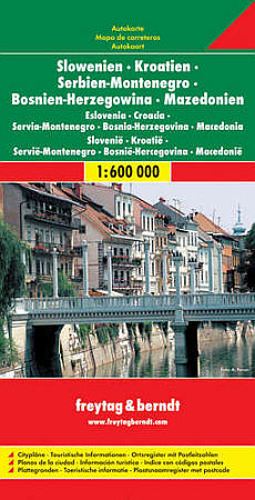 Scale 1:600,000. Freytag-Berndt edition. Indexed.
 - $19.95
Item Code : REIS5360
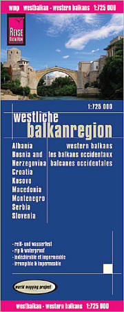 Scale 1:725,000. Reis Know How edition. Very detailed Western Balkans road map. English and multi-lingual legends. Printed on tear-resistant, waterproof, paper-like plastic. It can bend and fold without cracking and is writable as normal paper, non-toxic and recyclable. Perfect for tourist adventures and independent travel and for driving tours. Includes topographic contour lines and hypsometric color tints which show height levels, along with elevation numbers. Shows all major and secondary roads and tertiary roads, with distances between points in kilometers. Fully indexed. Beautiful cartography.
 - $18.95 Rolled + $6.80 p&h or $18.80 foreign delivery
Item Code : NATL5361
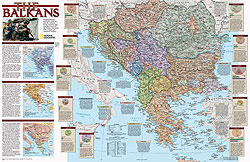
 Scale 1:2,800,000. Size 20"x30". National Geographic edition.
| Postage and handling is $4.40 for the first map and $1.80 for each additional map. ~ ~ ~ ~ ~ ~ Foreign delivery is $15.80 for the first map and $7.60 for each additional map. ~ ~ ~ ~ ~ ~ Canada delivery is $15.80 for the first map and $7.60 for each additional map. |
| Postage and handling is $4.40 for the first map and $1.80 for each additional map. ~ ~ ~ ~ ~ ~ Foreign delivery is $15.80 for the first map and $7.60 for each additional map. ~ ~ ~ ~ ~ ~ Canada delivery is $15.80 for the first map and $7.60 for each additional map. |
Use our Maps to explore the culture of 7 countries all at once – Go Balkans.
Balkans is a combination of many countries which either share the common border or create an enclosed space which has been named as Balkans. The countries include Albania, Bosnia, Bulgaria, Croatia, Kosovo, Macedonia, Moldova, Montenegro, Romania and Serbia. There are a total of 9 languages which are spoken in Balkans which is Albanian, Bosnian, Bulgarian, Croatian, Macedonian, Montenegrin, Romanian, Serbian and Turkish.
The total area of this country is nearly 6, 66,700 km sq, wherein you can explore the activities famous in all of these countries. Since it is an archipelago, here the activities include which you can explore with our maps can be climbing Haila Summit which is 2403 m above the sea level. You can go ahead and explore the countries which hosted winter Olympics that is Bosnia and Herzegovina. You can explore skiing in Serbia. Apart from these there are many other activities which can be explored at the fullest with our user-friendly maps which will provide you information on travel routes, roads, historical places and other landmarks, in spite of these you can also use our very friendly map to decide whether you should travel via land, air or water to the nearby location as their routes are mentioned clearly on the map via different highlighted colored lines, which can be interpreted easily by anyone.
The wildlife of Balkans includes mostly terrestrial species of animals which can be explored and enjoyed in the nearby national parks. Marine life is not that much in this city. People go for land routes in comparison to the water routes reason being the water cannot be predicted so easily in a city like this. The mountains on the Bulgarian sides are full of snow and provide scenic landscape. Trust me, the maps can make your trip more enjoyable. Probably to an extent where you may want to enjoy your next trip only with the map.
Balkans Road Maps for Tourists and TravelersDetailed Road Map of BalkansBuy travel maps for Balkans tourist attractions, road trips, street guide, driving directions and more |
